Showing posts with label whitewater. Show all posts

Saturday, May 25, 2013

MISTASSIBI NORD EST, QUEBEC, DAY 6 of trip (June 24 to July 1, 2012)

Day 6, Friday, June 29


Last day paddle was a piece of cake k968 to k50, k18, moderately pushy current but no meaningful rapids.


Took out just after k 50 bridge, on left. About 250 miles to La Tuque, a hot shower and dinner at Le Parasol.


MISTASSIBI NORD EST, QUEBEC, DAY 5 of trip (June 24 to July 1, 2012)

Day 5, Thursday, June 28

Weather improved and we enjoyed the spectacular scenery—craggy, bare rock high cliffs, some with mountain streams tumbling down to the river.


The current was always pushy and the river shallow in some places. Had to pick our way down a little bit.

No special challenges this day. Camped at k68 GB site, plenty of room with a large wood platform for gear. Hordes of hungry biting flies. Had the time and inclination to take a cold water bath.


Dinner was sausage in tomato sauce over spaghetti with fresh brussel sprouts (they transport easily).

MISTASSIBI NORD EST, QUEBEC, DAY 4 of trip (June 24 to July 1, 2012)

Day 4, Wednesday, June 27

This part of the river was particularly scenic with steep wooded banks, almost canyon-like and otherworldly.

 Long waterfalls coming down the cliffs occasionally on the sides.


The light rain created a mystic atmosphere. There were several tough R3s (at least one around a bend) that had to be thoroughly scouted by going bushwacking up the banks. The best routes seemed to be on river right. At one point we did some unintentional surfing in a hydraulic, which we were able to backpaddle out of.


We camped at a site K92 rated “tres beau” GB. There was plenty of room for multiple tents and fire rings. Had a small log bench. Mashed potatoes and corned beef hash with fresh beets for dinner. Rain stopped, saw a double rainbow and we were able to dry out some gear.

MISTASSIBI NORD EST, QUEBEC, DAY 3 of trip (June 24 to July 1, 2012)

Day 3, Tuesday, June 26


Light rain when we get up after rain all night. paddling started a bit tough. Somewhere around K138-139 took a lot of scouting for the S3 and R3s.


After some R2s we had the S5 mandatory carry and lunch on rock RL.


Portaged down the rocks to a steep put-in.

After lunch and the paper bridge, a stretch of 7.5 miles of mostly R1s with a little R2s mixed in. A hoot, even though it was raining.


Campsite was “beau site” pretty in that it had lots white flowers.

Dinner was a classic that Doug created and perfected. Chicken korma, fresh buttered green beans and brown instant rice.

MISTASSIBI NORD EST, QUEBEC, DAY 2 of trip (June 24 to July 1, 2012)

Day 2, Monday, June 25, 2012


Day started with lots of rapids of varying difficulty, R1, R2 and a few R3s. We scouted all the R3s and Doug lined the easy part of the R3 at K 156. We were still getting comfortable with the mapmaker’s river markings.


In the beginning we had plenty of R1s and R2s but also R3s. We hit an S2 little off and took on a boatload. Not a pleasant feeling with one inch of freeboard and the boat so heavy it can’t be steered. We kept the boat pointing downstream and soon had it on a rock. After some mid-river bailing we were floating again.

Nice campsite marked GB high up on the spit of a sandy bank.
Shrimp scampi dinner was a first, with pasta and carrots. A keeper. It started to rain before bedtime, which was 9 p.m. Black flies were particularly bad, plus added mosquitos thrown in for more annoyance. Site was full of fluffy white/light green flowers in bloom.


MISTASSIBI NORD EST, QUEBEC, DAY 1, June 24 to July 1, 2012

Day 1, Sunday, June 24


Sunrise was early, four or five; the birds made a racket. Out of the tent before six; lots to do. Coffee and pork chops that had to be eaten. (They were to be dinner but instead had wonderful spotted trout.) Walked and ate to keep the bugs away. All the gear had to be down to the lake and the truck delivered to our friend who was going to take it to the take out for us. Waiting for the float plane at the washed-out dock, we decide to move all the gear to the beach where there weren’t nails and broken wood. Kept watching and watching for the plane. The sky was perfect blue with a few painterly clouds. No wind, the lake very still. Then we heard the rumblings of some shore bird and the big red single Otter plane arrived with its white goose logo on the back—Air Saguenay.


The plane, a de Haviland single Otter had a new Polish Pezetel 1,000 horsepower engine. The pilot came right up to the beach, donned hip boots and jumped in the water to maneuver the plane even closer to us and the gear. He strapped our canoe to the right pontoon with nylon straps and heavy clamps. All our gear was stowed in the back of the plane. Doug gave Trish the co-pilots seat, which she gratefully accepted, Nikon in hand. We followed the path of the river up to Lac Machisque. 45 minutes, 72 air miles.


 What a treat to see the river from the air before navigating it. The landing was perfect and we taxied to the plage marked GC (group camp) on the map, the headwaters of the Mistassibi Nord Est. Kilometer 176 on the map.

We started off fast and checked the map for reliability, R2 S2 R2 R1 R2 S2 R1 R2. The first part of the river had a forest fire in June 201 so it was still pretty desolate looking, only low scrubby growth. We paddled 7.5 miles and camp at a 3C site around K 164. Dinner was especially memorable since it had been transported in a cooler for days. Steak, baked Yukon gold potatoes with sour cream, steamed fresh broccoli.

MISTASSIBI NORD EST, QUEBEC, June 24 to July 1, 2012

Getting to the Put In

Our adventure began well before we arrived at Lac Boisvert for the plane to take us to the put in. Some of it is worth recounting here for those considering a similar trip. Note, there are several other ways to start a paddle on the Mistassibi Nord Est without engaging a float plane.

Our account of this trip, started with the drive on the Abitibi Bowater Road, 12k, 78.7 dusty miles on the logging road. Our Ford 4x4 crew cab was able to do a respectable 42 to 45 miles per hour with the cruise control set. At any rate, that leg of the trip took two hours, following directions and keeping an eye out for various turns. At the designated mile, we crossed over the bridge (double, no guard rails) and found the road to Lac Boisvert, confirming that we had the right one with a middle-age couple on an ATV (many around) who spoke only French. They gave us further imperative: “Stay to the right.”

We took them rather literally and a couple of times had to backtrack as “the right” deteriorated into pure bush. The road up to the lake is very difficult. Huge rocks, steep inclines, only a few hand-written signs. Tough on the toughest truck. Rarely did we reach 10 miles an hour, mostly 5; traveling the 11 miles to the lake.

When we arrived at the pristine lake and the spot where we thought a plane might land, there was no sign of a dock. We went to the north end of the lake and still could not locate a dock. We eventually ventured down a driveway and found a chalet occupied by a family. The father told Doug (who speaks French learned in school and refreshed with regular visits to Quebec) that the dock had washed away; and offered to show us where it was. Sure enough, the sign bearing the symbol for a float plan was buried in the brush.


We found the path down to the lake and decided we would wait there for the plane in the morning–where the dock used to be. This was at the southern end of the lake. Across the road there was a gravelly open area where we camped. The evening’s beauty was marred by the onslaught of black flies. Retreated to the safety of the tent early.

Friday, July 30, 2010

Rivière du Lièvre Day One START HERE

Day 1—Sunday, July 18, 2010

Drive through the Laurentians to Mont-Saint-Michel and Zec Normandie where Eric shuttles us to put-in 662 miles from New Jersey home; whitecaps and storm on Lac la Culotte.

After overnight in Plattsburgh, New York, breakfast north of Montreal and then five hours more drive through the Laurentians and Mont Tremblant where the towns get small and smaller. After a turn off of 309 north of Mont-Saint-Michael, the road becomes gravel, albeit cars and trucks are travelling at 40 mph. We check out the take-out, which is on the way to Zec Normandie where we will meet our shuttle driver at the prearranged time of 3 p.m. Pay $37.50 camping fee (CAN$) and $75 for the shuttle. What a deal! Chemain Parent (road to Parent) is the road to the put in (mostly, there are a few turn offs toward the end that you have to navigate). Gets narrower and narrower. Only passable in a truck, in our opinion. Could wreck a small car. Pass through interesting little collection of cabins called Waterloo. Very very bumpy ride.
Arrive at put-in on schedule, and are in the water by 5 p.m., paddling across Lac a la Culotte. Nice and calm—for the first 45 minutes—until the wind picks up and we are in a rainstorm, whitecaps and all. A hard paddle the rest of the 5 miles to the first night’s campsite on the far side of the lake. Rain stopped enough to get tent up and dinner made—dried Italian sausage enhanced by a pacakge of sauce and spaghetti noodles, freeze-dried vegetable medley.

Rivière du Lièvre Day Two


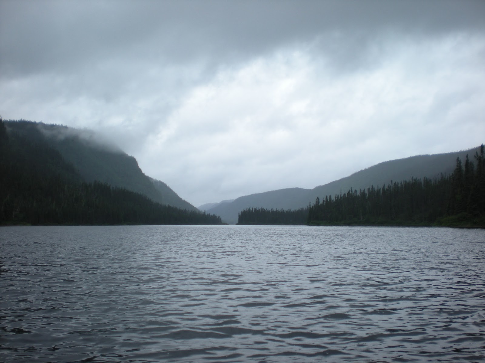
Day 2—Monday, July 19, 2010
Long (and only real) portage in difficult mud around a Class IV ledge, rainy lunch, Lac
Adonis, A-rated campsite,
swimming in rapids.


Woke early to the sound of the white-throated sparrow. Usual morning prep but skipped the fire and used camp stoves instead. Came upon rapids on the river right away. Scouted a few and lined two. Ran the rest; some good whitewater. Scouted part of a series that was to be Class II, III and a IV ledge. Took the portage trail to try and see the bottom of the series. Trail was long, boggy and muddy. When we got to end with one trip of gear saw a true IV ledge (falls) with very very fast water and not at all runable. Finished the portage, during which it rained heavily. Took shelter under a cedar tree with a moss floor for lunch of soup and cheese and crackers (our usual mid-day sustenance). Some fishermen were tryig their luch at the bottom of the ledge and then a grandpa and kids and poodle with a powerboat. With the river going into and out of lakes, we saw more civilization that usual or than we would later in the trip where it was all river-only access.


Finished the day with two hours on Lac Adonis, a little headwind but an early day into camp and a beautiful A campsite (our rating) on top a ridge with good water access and great swimming in the nearby shallow rapids. Later that night, around 8 p.m., we heard a ruckus on the lake side of the camp, just before the rapids. Two guys had anchored and were yelling in French to other boaters. One guy held up a huge lake trout, three feet long, possibly 25 pounds, showing off his catch before releasing it back into the lake. Before long a few more boats joined the festivities, fishermen talking loudly and casting lines every which way. As sun set, they left around 9. It got quite cold overnight and we slept in caps. A couple degrees cooler and we would have wanted to have 35 degree bags instead of our 45 degree ones.

Rivière du Lièvre Day Three


Day 3—Tuesday, July 20, 2010
Series of Class I, II and III rapids, Lac Bacon and Lac de la Table, lined Class IV ledge.


Usual morning fog and haze over the water. Two quiet fishermen where the boisterous ones were night previously. On the river before 9 for a series of I, II and III rapids as well as two lakes with pretty long flat water—Lac Bacon and Lac de la Table. Scouted the IIs and ran a couple. Would have been rougher and more standing waves if there were just 6 inches more of water. Scouted a IV drop on nice big flat rocks. Had lunch at the top, lined part and then ran the bottom, which was a Class III. All told, paddled 20k or about 12.5 miles.


Missed a recommended campsite and found discrepancies in the map we were using. Ended up in a decent one on an old logging road, a little narrow but interesting. Rock area for a bath. Hearty dinner of chili (from all dry ingredients—hamburger, red beans, white beans, tomatoes and Doug’s secret spices).


Rivière du Lièvre Day Four

Day 4—Wednesday, July 21, 2010
Toughest day, flat-water Lac Pine, rain, together
ran Class IV rapid, Class IV ledge,
bushwhacked campsite.


Seems like there is always a tough day and this was it. Lots of flat lake paddling and relentless rain. No rain jacket is 100 percent but fortunately the rain was not cold. Come midday and we are looking for anywhere we could have our hot soup lunch out of the heavy rain and wind. As if answering a prayer, we come across a fishing/hunting camp. If anyone was there we would have asked if we could just shelter for 20 minutes on the screened porch. But no one was about and fortunately the porch was unlocked. Thank you, thank you.


Somewhat fortified, we paddled Lac Pine, which was interesting with many islands. We checked the grasses to make sure we were going with the flow of the water. Ran the rapids at the bridge fine and then started a Class II, III, IV succession of rapids ending with a ledge that came up so fast we had to take it. Scouted and sucessfully ran a Class IV ledge that at first looked impossible but with planning proved a hoot. Checked out the “grand campsite,” (as termed by others at 280 km) and didn’t find it grand at all except that it could accommodate many tents. Poor fireplace. It was still raining so we decided to go a mile and a half to another campsite that was supposed to be at the end of the island on the left. Never found a sign of it. But, en route we did see two bull moose. Wonderful peaceful creatures that let us get close since we were so quiet. Also interrupted a beaver who had pulled a fresh branch to the lodge.


Came to a Class III ledge and started looking for anywhere to camp, briefly considered a sandbar in the rapids but them came across an abandoned site, all overgrown with moss and shrubs but with the vestige of a fire ring. Didn’t really like it but could not get back upstream past the ledge to reexamine where we might have missed the other site. Quickly set up tent on the bushwacked site and cooked on camp stoves, eating on the rocks because there was no place else. Tent was on very lumpy ground but tried to situate bodies to accommodate. A worn-down tree stump makes a pillow if you are tired enough. Rained hard that night but at least we were dry. In the morning we found an inch of water in the drinking cups.

Rivière du Lièvre Day Five

Day 5—Thursday, July 22, 2010
Doug ran Class V ledge with duffle, great whitewater II, III and IV, dramatic IV ledge, sunny private lake and A-rated campsite.


First thing in the morning, had a class V ledge with good portage on the rocks to the right. We were going to carry the whole thing but Doug decided to sneak it with one duffle as his seat and the rest of the gear carried. Ran fine but got briefly stuck on a rock at the bottom. Ran a good ½ mile of II, II and IV (brief) whitewater with only minor snags due to rocks and the water level. Some big waves, too. Fast going. We were determined not to miss the campsite around 268 km. There wouldn’t be another one until the take out. Scouted and ran a couple IV’s Ran series of II, III, all a hoot, culminating in a big IV banger at bottom boat scouting only. Scraped a small rock , but no sticky. Pulled over into an eddy because we had taken on some water. Sure enough, as promised, just around the right bend, was our campsite, the best yet, we rate it A.


An early day off the river, beautiful lagoon, no other boats around, sun to dry the gear on the huge expanse of high rocks. Took a dip in the deep refreshing water. Enjoyed log seats and a work table. Time to relax before salmon croquettes with Teriyaki rice and vegetable medley. Another cool night. Good sleeping weather.

Rivière du Lièvre Day Six


Day 6—Friday, July 23, 2010
Fantastic five miles to takeout, ledges and 1.5 miles of great Class II and III whitewater, would have been IV with more water.

Last day on the river, just five miles to takeout and we will be sorry to see it end. Used the camp stoves for breakfast and were on the river before 9. What an exciting stretch of river. A great reward for coming this far. An “easy” IV with a tricky sneak on the left. Then 1½ mile of endless excitement Cl III rapids that kept going and going. Heart-pounding beaucoup d'excitement! What a great way to end a fantastic river adventure. Mileage at takeout was 707. Picnic lunch (soup again) at Ferme-Neuve town park. On to Mont-Tremblant for a hot shower, rest at great B&B called Au Bois Jolit, and dinner in the old village at Milly’s (highly recommended.)

Monday, September 28, 2009

September Missinaibi River, Day 9


Rain overnight kept going into the morning. A bittersweet day, our last on the river. Most of the paddle for the first three miles was rock gardens. The light rain picked up and the headwinds became strong but we were determined to make our takeout on time, at 12:30, just past the bridge at Mattice. Winds were 20-25 miles an hour. An eagle soared above the left bank, encouraging us to solider one. Also saw a playful otter. Our shuttle driver James was impressed with our punctuality.


Although tired, dirty and wet, we enjoyed being in "the zone." The expedition turned out just as we had hope and planned.

Total miles paddled was 10.


Sunday, September 27, 2009

September Missinaibi River, Day 8

After only a mile of flat water in the morning, we came to Albany Rapids—welcome fast water. There were some ledges and Class II. We were not sure which one was named Sleeping Beauty. Hard to tell since Albany is a series of rapids and drops, all Class II technical, fun whitewater paddling and all boat scouts. There also are a million rocks and a few of the drops demand wise choices in a loaded boat. Boffo. By far the most exciting day and still more to come.

Lunch was atop Big Beaver Rapids with its dramatic rock formations other-worldly.
Enjoyed the view immensely. Like the rest of the trip, the falls and the river were all ours. We took the portage river left. Some honcho should scout it on the right and see if the drop is runable in an empty boat. This was the longest portage for us so far, a quarter of a mile and the first evidence of ATV activity on the river. Big tires gorged part of the portage and turned it into a quagmire (yuck!).

Little Beaver is a Class II technical but by this point a piece of cake.

At Sharp Rock, aptly named, the rocks are really sharp and the portage narrow. We carried some of the gear to the end of the portage. Doug, feeling frisky paddled solo to the right with two duffels. He liked what he saw and joined the ranks of Hap Wilson’s “incorporeal beings” and ran the drop. After the run Trish took a video of the drop on her Nikon.


Our assessment is that it is a Class III at these water levels. With a three-foot-wide slot you need expert boat control.


After two and a half miles of flat water we were at the top of Glassy Falls. Took the portage to the sandy beach at the end. The enjoyment of camping in sight of the postcard-perfect falls, sun setting beyond them, was fractured by the vast quantities of detritus, the residue of many drinking parties. Obviously locals on ATVs have a lack of respect for the environment and mother nature’s beauty. What a shame.

Total miles paddled was 16.