Thursday, June 17, 2010

KOPKA SOLO CANOE DAY 10 addenum


So it's in the truck and home three days later.
A great river, a real gem .

Great trip!!

Some general notes
This was a demanding trip both physically and mentally. Travelling solo really ups the neccessary caution level. This is for experienced canoeists and campers only. TIP: bring extra cord to replace stakes for the tent. You'll be pitching on bedrock more than once and tying up to rocks, logs whatever.

This river isn't likely to kill you but you could get in a real jam if you don't know what your doing and don't have an accurate assessment of your real ww skill levels. Being able to read rapids and currents is critical as well as a thorough, practical knowledge of hydrodynamics and what that can do to you and your boat. The upper Kopka would be a tougher slog for tandem paddlers (but doable) at the low water levels I encountered. Higher water (say up to 1 foot higher) would actually have made things easier and less technical. River conditions are going to change yearly as downed trees get removed or deposited with the spring floods.

If you do this trip expect to be using your imagination and creativity negotiating many of the rapids as you paddle, line and maybe sometimes push, pull and carry your way down. (I left out swimming , but you never know. . . ) Yes , I'd definitely put this on my do again list . . . but there's so many rivers . . . Chimo!

Doug aka serge88

KOPKA RIVER SOLO DAY 9 & 10

PHOTOS
TOP Photos L & R
The Mt. Goat portage. Don't trust that rope!iT'S 80 VERTICAL FEET
MIDDLE ROW PHOTOs : Me and third falls > a scene hard earned. LOOKING down over the abyss
********
BOTTOM PHOTOS, LEFT :My truck at the takeout. Where's the nearest pizzeria?
BOTTOM :HELLO BEAR!

*************************************************
The last of the three great waterfalls is just at the end of the lake on which I camped the night before. This biggy has the most difficult portage of the three, the famous "Mountain Goat " portage. It's the norm to do this portage river left, although another route exists on river right. I sort of wished I had at least checked out the other less-used side to see if it was indeed more difficult and longer (as said my old MNR trip notes). It may also have provided a better photo view from the top.

The portage is about 250 yards. Not difficult until the end where it drops a good 80 ft and is very steep, and vertical at the beginning for about 10 ft. I'm glad it wasn't raining. Operating solo the entire job was particularly arduous because I kept the pace really slow to ensure safety. After cutting up a tree that had fallen over the top that winter. (I was the first one on the Kopka in 2010!) I started lowering the gear down, then the canoe. the really steep part is the first 20 ft or so. Then it angles to a pitch that can be walked down by holding on to a rope. I didn't trust the existing rope for my own self, just used it for the gear. Sometime soon the rope tied to that top tree is going to break. It was good in its time . . . real kernmantle . . . but the years are wearing it out. If your going, bring your own rope -- the old stuff might be gone or if not, you probably won't trust it. A few carabiners are going to come in handy, too. The D-Roller tm is a nice one for using as a pulley. I had two with me.

I think the entire portage took almost three hours. In a group the time would be much less because things could be passed up and down. I had only myself there and when all the gear was lowered over the edge, boat too. I followed down on a one-way trip all by myself. The lowering was all done in stages. First a quarter of the way, then the rest. There's enough slope "platform" to keep things from going all the way down in freefall. I anchored a rope to a deadfall to hang on to as I moved down the rest of the way. The top part you climb down straight vertical.

When everything was at the river's edge at the bottom I paddled across to the other side and had lunch at the campsite there. You get a great view of the falls . The campsite though is used somewhat by locals (it's obvious) and a little on the blemished side -- trashy is too strong for it, but time may make it so. Not bad but glad I stayed at my little lake site upstream.

The course out of the canyon is beautiful and a fitting farewell path from the falls. Wigwasan Lake is large and uneventful. It's obvious that heavy winds could wreak havoc on any canoeing on this lake and Lake Bukemiga, but I was fortunate. The narrows into Lake Wigwasan are easily negotiated. About 2 miles past the rapids of the narrows, still in the SW arm of Lake Wigwasan, there is an island with a nice campsite on the south side. I took a break there and noticed a raven had built a nest in one of the nearby pine trees and her little darlin's would make a real racket when she came in with a mouthful of groceries. They probably nest there every year, so you may not have missed out my friend. Also this island would be a good place to stay on overnight if the winds were bad and going to tear you up when you hit the open water of the main lake. It was actually more pleasant than the more humanized campsite at the Lake Wigwasan/Lake Bukemiga connexion trail.

The course can be run easily between lakes Wigwasan and Bukemiga -- by now your an expert, right? Just stay to the right hand channel at the end where the water is deeper and you'll be fine. I checked out the campsite there, where I had originally planned to camp for my last night and decided it wasn't that great, so I just kept on. On Bukemiga, it was raining and I was concerned about the wind picking up the next day so I decided to camp at the takeout and drive off the next morning. In retrospect I should have spent one more night in the real bush instead of the very civilized camping ground/trailer park of the takeout.

There is actually a nice little campsite nestled in the woods on the right bank of Lake Bukemiga in the southeast arm just before it bends right and south for the last 1/3 mi. of paddling. Camping here the last night would just have meant a 20 min paddle in the morning in a protected inlet of the lake, and a fast exit.

Be that as it may, I proceeded to the takeout where I was met by a great furry dog of one of the local fishermen. There were some summer locals camping out in their trailers and they were a friendly bunch who insisted on giving me a few free beers and ultimately a great chili dinner to boot. There was plenty of grass, not rock now, on which to pitch a tent and I knew I wasn't in the wilderness anymore when an electric generator got going. But I had my earplugs, which I use anyway when sleeping near a rapid or waterfall, and I slept like a baby. In the morning I was offered a mug of steaming mocha by my buddy in the trailer and I know I'm back in civilization for real.

The truck gets loaded up and I say my farewells. On the way out I pass a black bear half sitting, lazily eating grass by the road. I roll down the window and say "hello bear !" He doesn't move and looks at me languidly, the expression on his face saying , "You must be new around here , Cheechako. "

I drive off . . . what a trip!

KOPKA SOLO CANOE DAY 8B photos


MORE PICS!!!
Top: Indian Moccassin orchid . . . springtime delight in the north.
Middle: This is the rapid for which I discovered a portage trail after lining became decidedly risky. That current is moving fast and the end drop approaches Cl IV for sure.
Bottom: Checking out #2 falls. I would camp on that little "way down there" lake in the background.

KOPKA RIVER SOLO DAY 8


PHOTOS
Bottom: First falls from the boat.
Middle: Second falls. Note canoe to left, bottom of portage.
Top: End of a perfect day, enjoying the solitude and beauty.
***************************************************
I wake up anticipating the day for this day I will arrive at the BIG Drops where the river plunges 250 feet in 1/4 mile. I paddle to the end of Lake K. and note the campsites on the bluff . . . they look "A" grade appealing. The lake turns east and the sides close in and the river begins again.

I'll note now that no one has to worry about being swept over a huge waterfall on this river .All the three major falls have plenty of still water before them to spot the portage and easily navigate the boat safely. The rapids that precede all the three falls however are in some sections significant and will require more than just paddling. Leaving the lake there is an easy shallow rapid that can be boat scouted, then quiet sections with current. The next significant rapid is rocky and will probably need scouting as there is no direct route down it. After zig zagging down it I ended up lining the last bit on the right. With higher water levels this rip would change dramatically, so the next guy will have to do what I did . . . take it as it comes.

The final pre-falls rapid starts easy and quickly becomes a nasty technical Cl III+ nightmare. I figured I could go down as far as I could, then line it the rest of the way . The shore is essentially useless for movement however and any lining you do is going to be mostly in the water -- slippin' and a slidin', ho ho. I decided to go to river left and head inland to see if there might be a portage trail I had missed, since this place is such a mean dog to line and risky, too, for man and boat. The water is pushy enough here that if your "Queen Mary" or "Henrietta" gets away from you she's likely to get pinned good and you've got some serious Z-dragging to do to get her free.

Sure enough 50 ft from the river I came across the portage trail. Where it starts is anybody's guess because it got past me. I hauled the boat and gear to the trail through the bush and performed the required grunt work. All in all, better than lining.

The first falls of the" big three" appeared after a short quiet lake section and there's plenty of time to spot the portage, river right. The 350 yds is pretty easy until the last 100 feet then gets interesting. The trail itself goes down a very steep "path," the last part of which involves some short vertical drops. This is not too difficult with packs. I worked it out without using ropes . . . except for the canoe. Two people working together could probably get a tandem boat down the normal trail ,but by myself it would be more problematic. So I chose to lower the boat right over the adjacent cliff, about a 25 ft drop. This I did using a carabiner and pulley to get some increased mechanical advantage (and not lose my grip!). It worked out well. Some great views and photo ops here and at each of the other falls.

Note there are campsites at each of the three falls portages ...so you can quit for the day wherever you want. My choice was to do two falls/carries on the first day and the final one the next. Turned out to be the right choice. The best campsite by far (IMHO) is on the small lake just below the second falls.

The next (#2) big falls also has portage on river right . It's shorter( 150 yds ) and also at the end has a step drop ( the "cave"). There was still a big chunk of winter ice in the cave when I looked in. Check it out. The second falls is the narrowest of the three. Watching all that water come ripping down a 20 ft wide slot is awesome, an appropriate use of that very overworked word.

The little lake that you then enter has a "A" campsite on the right, just as you leave the falls canyon. Prettiest lake I've ever had the pleasure to paddle ...quiet , intimate ..with big picturesque cliffs on three sides ......and check out the waterfall tumbling down to the right as you enter. The campsite as I said is a honey. Easy access, level enough, fire ring ready, not too buggy, plenty of wood, nice rock shelf for swimming . . . and a decent place to set up the kitchen -- plus a great view!

I pitched camp, swam, cooked dinner and enjoyed this bit of heaven . . . and wouldn't you know it, after a full day of paddling and 'packing it was such a perfect little lake I had to get in the canoe and paddle around a bit just to take it in even more.

KOPKA RIVER SOLO DAY 7


PHOTOS
Top: Scene from my pretty Lake Kenakakaniss campsite (A).

Bottom: The Long Mean rapid leading into Lake Kenakakaniss.
*************************************

DAY 7
I got up and struck camp and carried the gear to the end of the portage where I had yesterday paddled the canoe. I would be heading generally east today until I got to Lake Kenakskaniss. There was supposedly a 36 ft waterfall indicated on my topo map 1/2 mi. downstream from camp but it turned out to be an easy Cl II run ! . . . go figure! My map was official Canadian government. They must have had a few Labbatt's Blue that day . . . but map is old . . . wonder if they've fixed that error.

In a couple of miles the river drops over a significant, wide 15 ft ledge, taking various channels . It's an easy 100 yd carry on river right. Nice campsite there, too. After that it's an easy few miles to the rapid entering Lake Kenakskaniss. Portage is on the left, 400 yd, and everyone is going to walk this one. This rapid is a 1/4 mile of hard technical Cl IV with a few deadfalls randomly tossed in. If it were in PA or NY it would be a "WW Mecca "site and all the hardcore OC1's and yakkers would come to play all day and get to know every rock. But this is the wilderness. Your first time down and Pizza Hut is a long way away, so you walk. Could you line it? Sure. But it would probably be riskier and take as long. Take the cannoli , leave the rapid.

Lake Kenakskaniss is long and for the first time I was heading south over distance so I was concerned about headwinds, but they were light and not a problem. There is a nice small campsite 2/3ds of the way down the lake on right, but if you're keen you can go to the south end of the lake and a couple of very nice larger sites are on the cliffs overlooking the lake. I chose the first small campsite, perfect for one or two tents.

Warm weather, another dip in the lake and I was (literally) a happy camper.

KOPKA RIVER SOLO DAY 6


PHOTOS
Top: Taken from the nice "A" campsite after dumping in the (unseen) upstream rapid . . . hey it was a hot day, I needed to cool off! I carried the visible C IV drop and ran the empty boat to the C II+ ledge downstream.
Middle: You can see all the lumber upstream , but I only had to lift over one river-wide log.That was a lot of effort with the fast current and slippery bank. The fun drop in the foreground I ran for my reward and made the eddy from which I took the picture.
Bottom: This is the rapid I ran below the bridge day 6. The portage was a mean one and after serious time consumed scouting, I took the loaded boat down it. The river really gets narrow here and the current is pushy. The top of the rapid was the hardest to scout . . . but there is a line down this sluice.

********************************************************

To Lake Kenakskaniss (from my day 5 campsite) ascertaining the exact location is difficult (unless you take a GPS device). The water is a succession of narrow lakes and river and there is plenty of interesting whitewater. This is really a fun part of the river to do. . . lots of variety. After passing through a couple of small lakes the river cuts north for about 2 1/2 miles. At the point where the only bridge on the river is seen there is a little rapid. The bridge is in disuse but 4 wheelers are obviously still using it. Unfortunately an open space just off the road has collected some human trash, which can't be seen from the river I'm glad to say.

After the bridge a rapid with portage is approached. The portage is on the left. The rapid runs through a narrow little gorge and is worth scouting if you fancy running a solid C III to avoid the difficult rough 250 yd portage. I ran this section with gear and got through unscathed. In one place the entire river reduces to about 4 feet wide. I sure didn't want to do that rough portage! The top of the rapid is the crux. Get your alignment right there and you should be OK but you'll work hard to access the view and get the planning done.This was one of the the most difficult rapids I chose to run concerning execution and potential risk.

The river continues north a couple of miles and then generally heads east for about 8 miles through a series of small lakes and rapids/ledges before entering Lake Kenakskaniss. The first major rapid was tough as it has some deadfalls that went right across the channel. I ran the first 100 ft, had lunch on a rock, then lined down over a ledge to the deadfalls and carefully emptied the canoe and pulled it over the trees. This was demanding and tiring work as the current was strong and the shore offered little good ground. After negotiating the lumber I ran the rest of the rapid and lined the last 20 feet into a calm stretch. Hopefully next year's spring flood will clear that deadfall obstacle. There's no portage trail discernible.

A couple miles later the river has a nice series of drops of varying difficulty. I ran the first on extreme right (there were multiple channels to choose)--a tight exhilarating little Cl III. The next drop was a Cl IV with an interesting ledge river right that went hard left after an initial 4 ft drop. Since there was a reasonably quiet section just below it and it didn't appear to present much likelihood of a pin, I decided to go for it. The 4' drop went great but sluicing through the hard left maneuver I met water forces not foreseen and ended up capsizing. The current pushed me through the gap and I quickly self-rescued. I would have loved to try it again in an empty boat but I was tired after a long day and having discovered a nice campsite right there on river left, pitched camp and dried out.

The campsite was actually on a portage trail for this section. I carried the boat beyond another CL IV drop and ran it the rest of the way down to the bottom of the portage. Once again it was a hot day so I decided to take another swim, this time voluntarily. Everything dried out quickly. A good day had ended.

KOPKA RIVER SOLO DAY 5


PHOTOS
Top: Dinner on the bluff day 5.
Middle: wringing the water from my socks end of day.
Bottom: Typical portage 70 lb of packs.


*************************************************
From the river campsite to Sandison Lake there are plenty more rapids. I saw a sow bear and two cubs an hour after leaving camp. Later around a left hand turn I encountered the only Cl III rapid in this section. It started with an 18 inch ledge and then required some technical maneuvers. The water was low enough that I had to drag the boat over the ledge since the boat would stick if I ran it loaded. If there was more water, other channels would open up and it would be runnable fully loaded by a good paddler. There is no portage here and it's going to demand the tripper's attention whatever the skill level. Any C III tech rapid in the wilderness being run for the first time is worth repect.

Sandison Lake is a brief interlude before getting back on the river. There are a couple of obvious tent sites of good quality that you will see here. On leaving the lake more rapids are encountered. My topo map indicates a 16 ft waterfall about 1/2 mi. after Sandison Lake . It is really a C IV- rapid , about 85 yd long. Portage on left. After this portage there is a quiet section then more rapids , then another lake about the size of Sandison but unamed. You'll pass a decent rocky campsite on a big island in this lake.

The next river section has another C IV drop where there is a fair campsite on the bluff above the portage trail on left. That afternoon the sky turned ominously black and there was a severe thunderstorm. Being up on the bluff was unerving with the thunder and lightning all around. I put some extra guy lines on the tent and crawled inside. . . and survived. The storm abated and I made dinner. The moon came out and reflected on the water below. . . nice.

Wednesday, June 16, 2010

KOPKA RIVER SOLO DAY 4


/kopka+river+095.JPG">


PHOTOS
Top: Lunch on Uneven Lake at good campsite.
2nd from top: Scene from river campsite.
3rd from top: Cooling off.
Bottom: The intimate Kopka.

******************************************************************
Awoke to another nice day and shipped out. I had camped at a narrow part of Uneven Lake and soon was in the last big part of the lake. . . it's a long body of water. . . glad to get it behind me. Thank goodness still had a tailwind. There was a complex of modern cabins in bay on the left which I paddled past. Near the end of the lake on the left (west) shore is a very nice "A" campsite where I stopped to have lunch. Soon I would be finished with lake travel for a while and getting into more river.

The forest fire area was past and the woods looked inviting again. The river between Uneven Lake and Sandison Lake is I think the prettiest part of the Kopka. Maybe not spectacular but seemingly the most pristine and intimate.

It was in this section that I saw a cow moose and the next day a sow bear and her two cubs. Lots of wildlife and old growth forest. There are lots of exciting Cl I and II rapids as well. I camped at a very nice "A" campsite about a third of the way to Sandison Lake. It rained a tiny bit but did not dampen my spirits. I had seen the cow moose earlier that day after running a little rapid and turning a corner in the river. She was old enough to expect a spring calf with her but early death by a bear or other misfortune may have claimed it. Despite being in the woods with lots of water, the bugs were surprisingly light.

Had a nice swim to cool off, made a fire and cooked dinner. What a great day.

KOPKA RIVER SOLO DAY 3


PHOTOS
TOP: The Kopka struggles to become a river.
MIDDLE : nice view from this campsite . Note skeletons of burned trees in background rising above the new stuff.
BOTTOM : My gear spread out on the rocks after a long day before I set the tent up.


***********************************************************************
Day 3 and it's another nice hot day. Waterhouse Lake is a straight forward paddle and once again the wind is at my back. Just before entering Gaal Lake I note a really nice "A" camsite on the left on a rise of land. It has a great view. After Gaal lake the Kopka becomes a real stream. It's small, narrow and has quiet sections as well as occasional rocky little rapids. Still not big enough that you'd ever call it a river.

I was able to run most of these rapids, lining a litle bit of one and having to jump out and get off a rock I was hung up on another. No real portages. If there had been a little more water theses maneuvers would have been unneccessary and as I mentioned, fine for tandem boaters too. As it was, I was glad to be in the SuperNova with its agility. At one time(from old MNR notes), one of these rapids had a lot of deadfalls and was impassable but I encountered no such obstacles. . . .of course things can change from year to year. Some of these rapids deserve a CL II/II+ rating for their technical requirements, others strictly class I. They weren't steep enough to be considered dangerous however , just demanding. In a tandem canoe you'd maybe be doing a lot of jumping out at these levels because of the rocks. More water would resolve that problem.

The little unamed lake after Gaal Lake has a small "B" campsite on the south shore. After you enter the river again there are several more rapids again demanding some technical ability to negotiate. Some are quite rocky. All in all a lot of fun.

Day 3 turned out to be the longest paddle day (17 miles!) because I could not find a suitable campsite where I thought there would be one. The Kopka has a final rapid before it enters Uneven Lake and there I was expecting to find a campsite based on my 20 yo MNR notes. Nno such luck! I couldn't even find a remnant. Should have maybe pitched on the south shore 1/2 mile into Uneven Lake where I saw a sandy little beach where a stream entered but I thoght I could do better. . . not! So, I kept paddling 5 more miles. The landscape turned Outwordly as fire-devastated land took over, eerily quiet. Finally pitched camp on bare rock site, albeit with a decent view, and little trees and shrubby plants all around trying to survive another year. Had another swim; it was HOT; I was tired.

KOPKA RIVER SOLO DAY 2


PHOTOS
Top: Relaxing cooking dinner 2nd night.
Bottom: Watershed portage trail lower end--looking at Redsand Lake.
Middle: The cozy lagoon day 2 camsite.
**************************************************************
After a night at my "C" site I finished the portage to Redsand Lake. It should be noted that this portage crosses the water shed between the Arctic and Great Lakes. There used to be a "marine railroad" made of jackpine logs and a cart with old car rims that could be used to move a gear loaded canoe from one system to the other. There are still traces of the pathway and a few old wooden ties to see in places, but most of it is gone. The uniqueness of this portage was one reason I've wanted to do the Kopka from its headwaters.

The little SE bay of Redsand Lake opens to the main lake and there on the right is a bare rock "C" campsite that offers a better view and fewer bugs than the portage trail site I used. There is another bare rock "C" site on the left shore about 2 1/2 miles further on. The land here is still recovering from a massive forest fire so vegetation still seems stunted and struggling...no good shade for a few more years .... but lots of fire wood.

Seiss Lake starts definitively after passing through a very narrow channel and opens up where there are a lot of islands. It's hard to get lost though--you just head north. The wind was gentle and always at my back. About a third of the way up Seiss Lake the lake narrows again and there is a nice "B" wooded campsite on a spit to the right before the narrows. After these narrows the lake is less island cluttered and in four miles takes a bend to the right (east). In 2 1/2 miles, after passing by a fairly large island, at the next narrows there is a really nice "A" campsite and this is where I pitched the tent for my second night.

The weather was particularly hot and I took the first of many swims on my trip. This campsite has an ideal place to harbor and dock the canoe and have a nice swim--kind of your own personal lagoon. To top it off, I enjoyed a beautiful sunset.

KOPKA RIVER SOLO EXPEDITION DAY 1 start here


PHOTOS
Top: Me at basecamp in front of De Haviland Beaver.
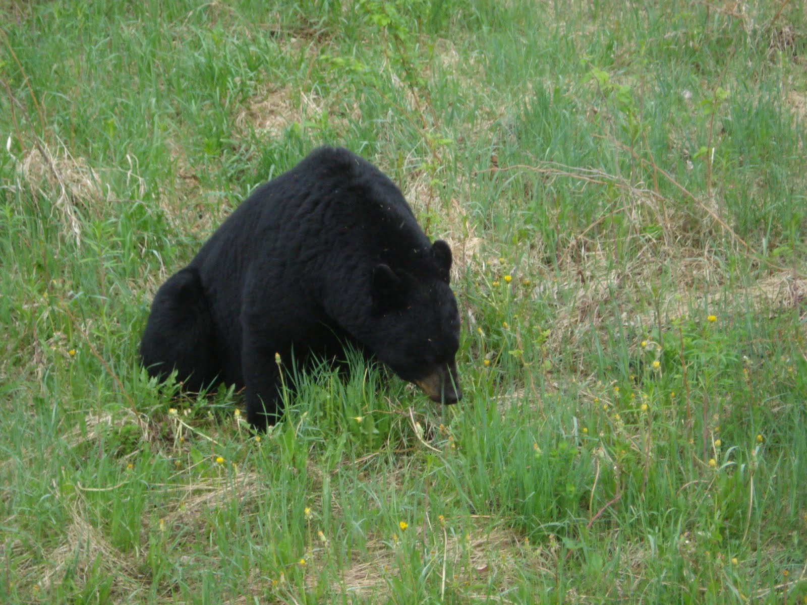
Middle: Kershaw lake at oulet portage( click x); Bottom: lining canoe at Savage Lake outlet(Kashishibog "river").
**************************************************************
Note: The Super Nova was rigged for a spray deck, but I never used it. You won't either on this river--maybe the lakes if it's really windy and choppy. This time of year and in the summer the winds are mostly south westerly. That's good because you won't have to battle the wind too much on the lakes that punctuate travel on this system, since travel on them tends to be some aspect of "northerly." If headwinds do come to bear consistently on the lakes it would be a tough slog.

Also, if this had been a tandem canoe trip it would have been more difficult especially on the upper Kopka because of the low water levels. The low levels made for a real technical challenge in negotiating the upper reaches which is really small-creek size and not a river. Having a shorter, more maneuverable solo canoe really helped getting down some of the rocky twisty little sections of this river.

Alternatively another 10" or so of water ,especially in the upper Kopka would have made tandem canoeing a real fun blast--some of those rocks would have been washed out and the channel more straightforward. More water could possibly allow for a "glass" boat if you were careful ( and skilled).

If a reader has any questions regarding this route email me at the canoe forum (< myccr canoe routes) and I'll try to answer .

THE TRIP
After a 3-day 1,600 mile drive from New Jersey USA, I arrived at my outfitter's base, Mattice Lake Outfitters, owned and operated by Don and Annette Elliot. The camp is 5 miles south of Armstrong Station, Ontario and you'll find good accommodation if you rent their cabin for the night which sleeps up to 6 and has a nice kitchen and hot shower with decent water pressure...cost about $100, which is what you'll pay for a cheesy room at some motel on Hwy 17. I had dinner in Armstrong which is a small railroad town and doesn't have much to see or talk about. There are two restaurants--take your pick--and they offer food that you might expect at the end of a 150 mile empty road, which is where Armstrong is located. Folks are friendly enough though.

If you're staying at Don's cabin you should bring you own bedding (sleeping bag/pillow) and it wouldn't be a bad idea to bring your supper in a cooler to cook in the kitchen, which has a great stove and fridge. You can watch the float planes land and take off from the front porch.

DAY 1, May 20th, 2010
I was up early and ready 8 AM since I was the first plane trip out. Kelly the pilot lashed the boat to the strut of the De Haviland Beaver after my gear had been loaded. estination was Kershaw Lake, part of the Kashishibog River system. Someone from Mattice Outfitter was going to park my truck at Bukemiga Lake for the takeout. My plan is to paddle down the Kashishibog, and portage in to the Kopka system at Redsand Lake. This is sometimes done from the opposite direction from the Graham Road, paddling up the Kashishibog via Sparkling Lake and then portaging into Redsand. It's one LONG car shuttle for that. An alternative fly-in could be Sparkling Lake. This would involve some brief upstream lining but the Kashishibog is more a small creek and easy to get up. The added benefit of this route is there may be some better campsites available where the Kashish narrows after Sparkling Lake than on the route I travelled.

A good part of this area was devastated by a forest fire about 15 years ago and the landscape shows it. Kelly the pilot landed me on Kershaw Lake and departed. There is an abandoned cabin on Kershaw Lake that has a decrepid dock that he motored right up to. Kershaw is an easy paddle to the disharge of the Kashishbog at the western end. It narrows down considerably here and there are some rocky shallows to navigate before the actual stream that takes you to Savage Lake. The stream is completely clogged with dead trees, but there is a real easy 50 yd portage on the right. Maps may show a road at the western narrows of Kershaw Lake , a continuation of 811 actually. But forget about using it as an access--it is overgrown and unusable, no bridge or sign of one now.

Savage Lake is a small , pretty lake and you'll be across it in no time. At the outlet I saw a bald eagle and it looked like they liked to hang out there as the stones were littered with eagle poop.
The outlet (Kashishibog "River") was just a small stream and shallow enough I had to line it down a short 20 ft. A little more water and it could be paddled. There were no more portages or lining required until I reached the portage into Redsand Lake.

In two miles entering the main part of Kashishibog Lake it's important to maintain your bearings as the many islands make orientation difficult. keep your topo map handy and consult regularly. Best to get to the western shore soon, going between the islands (I chose the shallow channel between the northerly two big ones) and then down about 1 mile to the lake narrows and another section of the Lake Kashishibog begins. Where the lake narrows there's a good camp/lunchsite on the left. After the lake widens out again you'll see a cabin on the west end of an island, then it's about 3 miles to the portage to Redsand Lake. Nothing too difficultso far. There are no pre-used campsites until the portage but you can rig up something on the numerous bare rocks almost anywhere. The portage is easy to locate in a small bay . Being civic-minded I wrapped some pink construction tape around a tree to make it even easier to spot. . . at least for a while.

There was a campsite listed in my notes at the end of this portage but it was so buggy and poor I decided to bushwack a camp about 1/3 of the way along the portage and finish the trail the next day. Since this is not a difficult portage (500 yd but only rises about 20 ft total and only minor mucky area), I think it would be better to have found a nicer campsite on the rocks before arriving, albeit still bushwacked, and enjoyed better scenery and fewer bugs. As it was I needed the DEET and bug hat to maintain sanity. For the rest of the trip the bugs were not as bad as here, though.