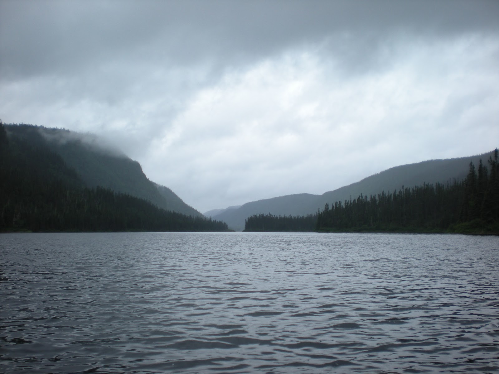
BROADBACK RIVER
DAY 1
September 11, 2011
put in K232, James Bay Road
Steep incline to the put in under the bridge. Our shuttle driver and companions were helpful in getting the gear down to the boat. Flat water with headwinds. Hard going. Paddled just 6 miles.
Decent sandy beach campsite on island (K131 river left on left) . Flat and sandy with grass. Not ideal but acceptable. No beach, though, where indicated on map.
Dinner was pork loin (fresh) with apple sauce, scalloped potatoes and broccoli (fresh).
DAY 2
September 12, 2011
Put in 9:45 with spray deck for big water rapids. Little or no headwind. River is wide then narrows at 115 kilometers. Lunched near where supposed to be a campsite (nonexistent). Saw big moose prints and bear prints in mudflats there. This was a scenario to be repeated on the Broadback. The map was very unreliable regarding campsites.
Could not find any designated campsite but found decent beach near tent cabin to camp at K112. Nice dinner of spaghetti and meat sauce plus fresh carrots on beach. Around sunset, heard a loud splashing at shore. Turned around to big bull moose making his way out of the river.
Set up tent on flat hard beach. Decent site. Put up tarp in woods near tent cabin for gear.
Covered 12 miles.
As we went to sleep at 8 and the wind was picking up. Put earplugs in. It started to rain around 11. By that time we estimated winds were 40 mph. Around midnight we both awoke to a strange thumping noise. The 17 ft. Royalex canoe had rolled 60 feet down the beach.…blown by the wind. Doug dragged it up to the bush near the tent, parallel to the shore, against the brush.
Doug secured the tent, putting up guylines weighted by rocks. By now it was past midnight and the winds were raging. Somehow we both fell asleep with the tent rattling around us.
DAY 3
September 13, 2011
Violent weather all night with rain and wind and gusts 40 to 50 mph. Overnight the wind had shifted from east to west, 180 degrees, which made us think that we were in a hurricane-like situation. The tent guylines had to be changed. The tent was taking quite a beating and we worried that it wouldn’t hold. The poles were bending and near breaking. Wind does not let up. We moved the canoe to the windward side of the tent and Doug weighted it down with rocks to act as a buffer against the gale-force winds. Wind-bound for the day! Used the plastic-walled tent cabin nearby for protection from the elements and were able to cook late lunch of fortified soup with extra green beans. Since no strenuous paddling, skipped dinner. Turned in early not much else to do. Spent another wind-filled night in the tent, which was tenuously holding up.
DAY 4
September 14, 2011
Woke relieved that tent and gear was intact. Wind had died down in night but it was overcast and threatening. Time to hit the river. Thought for sure we would be a day late ending trip. Knew we had extra food and shuttle guy would figure out that we had weather delay. He was a Cree who lived in Waskaganish. First R4 before Rooster came after a sharp left in the river. Map said to line and lift or run on left. However, we determined it was easier to lift on right. Paddled upstream 100 yards and ferried over to right where the shore was less rugged. Rooster was as spectacular as expected. Portage trail on right well identified. Not too tough (especially compared to what we would experience later that day).
Washing Machine ran a little, lined a little and portaged on right. Slippery rocks right against river began portage of Rinse Cycle. Saw no trail or indicators. Decided to go up on right and look for portage trail. Pushed through, bushwacking on two trip of four-trip portage. Rain made it even more treacherous and exhausting. Somewhere on third portage found a semblance of a trail in burnover. Very rocky toward end. Bushwacked campsite at highpoint at end Rinse Cycle rapids with blueberry bushes. Somehow managed dinner of chicken korma and rice in the midst rain and sleet.
DAY 5
September 15, 2011
Long way to go. Only at K102.
 Lined Agitator on left and portaged on left at Dab campsite. Had lunch there. Would have been a nice campsite but couldn’t call it a day early. Easy portage on right for Kawisipapachipiskach rapids. Ran a tricky technical R3 at the bottom of the portage. Didn’t get make much progress this day. Hard headwinds send us ashore. Could not make it to campsite around K94. Walked the shore a bit hoping to find something better than mud. Set up camp at K96 on left in the rocks and muck yuk. Yummy corned beef hash dinner on the camp stove.
DAY 6
September 16, 2011
Long, tiring, frustrating day that ended gloriously.
Maschiskach Kaminikapusito rapids lined and ran left (after scouting to see that there was a tight line to run between two rocks.
Portage at K92 right was really tough. Lots of rocks, which were big and tough to clamber over, especially carry the heavy packs. Lots and lots of blueberries on portage. Took the left fork of the portage, which made it shorter and gave us a class 3 run at the end. Relief. Paddle to k88 without rapids. The map indicated that there was portage trail on left at Tupatukasi Falls. Spent a precious hour looking for it. Nowhere to be found. Tried the right side where there was a dry riverbed. Doug went ahead and scouted. Saw a bay eddy right and the top of the falls, to the right. Trail and campsite popped into view. Paddled into the must-do eddy. A short ascent led to a beautiful campsite on the top of the falls. First sunshine of the trip; saw rainbow over falls. Had campfire, dried gear, chicken with and pasta suprise (plus fresh beets) for dinner. And enough time to watch sunset and look for Northern lights before hitting the sack. Needed earplug for roaring falls.


DAY 7¯
September 17, 2011
Long portage to start day. Begin on rocks next to top of the falls. We did it in two stages. First stage, along the river back, through the bush a little bit to an open area with blueberries. Second stage was more through woods to rocks again. Then put in. Took time to enjoy the majesty of Tupatukasi Fall. Portage took three hours all told and didn’t start paddling until 12:15.
Ran R2s and R3s (Rock Nest) then slammed by the wind. Six miles of headwinds. Only did 6 K(8.5 miles) that day. Before we camped at Cree cabin site on right, saw a helicopter across the river delivering a boat for a hunting camp. Earlier that day had seen another helicopter, the first evidence of anyone else on the river the whole trip til then. Dinner was ham and Mexican rice with brussel sprouts
DAY 8¯
September 18, 2011
Best day weather, a little sun. Mudy mucky put in to start. Lined and ran Cannonball (K 72) and Quickie (K 71) Decent swifts and Side Door ran. Lined right Interview R3-4 at K 64. G t to nice rocky campsite on left at top of a nice R3 to start the next day. Had a little time to dry out gear on rocks Dinner chicken, Chicken, mashed potatoes and gravy. At K 57 have 34 miles to go – in two days if keep to schedule!
DAY 9¯
September 19, 2011
Lots of interesting rapids to run. Great canoeing. Tricky time atK46 where river map notes show an R2 that was really a 3 4, then an R4 that was really an R2. Scouted then ran the R3 line on right, extreme right avoided R 4 in the middle. Scouted at the peninsula bend to right and avoided nasty stuff around corner. Then had a long hard and rewarding R3. Felt good to have the spray deck on, a little excitement with the big waves.
Started to rain in the afternoon. Long long paddling with no sign of a campsite on the flats. Decided had to keep going paddle past water monitoring station in hopes of finding campsite at the final rapids before the inlet at the bay. Rain rain rain added difficulty to an already arduous day. Set up camp on moss bed in raid. Cook Kraft macaroni and cheese with hamburger (dried) and vegetable medley side on one stove. Dinner in the dark. Exhausted. Nine hours on the river. K20. Don’t know if we can finish the 12 miles to Waskaganish in one day.


DAY 10¯
September 20, 2011
Start off fast with rocky rapids and big waves, R2 plus. After rapids. Head winds in the inlet, and waves. Paddled along the right shore but hardly made progress. Paddled two hours to go two miles to the Indian Cabins at K17. Stop there for soup lunch with cheese and crackers. Winds were coming from the south and pushing us to shore. Two more hard miles to round the point, get into Rupert Bay estuary and hopefully have an easier time. Fought the wind and waves and the outgoing tide, paddles hitting bottom frequently. Had to quarter the waves to maintain stability. Five long hours of fighting bay waters. Ultimately headed into the grass to avoid the waves. Had tidal charts with us and rising tide started at 4:30 p.m. so we knew we wouldn’t get stuck on the flats. Not much clearance for the boat. Once spotted Waskaganish village in the distance had at least another hour of paddling, some in grass to avoid wild waves out the inlet. Seemed to take forever coming in. Finally beached the canoe and got to the lodge hotel where we connected with shuttle guy to get our truck, fast hot shower in time to make dinner hour. (The dining closes 7:30.) Pork chops and greasy gravy mmmmm.