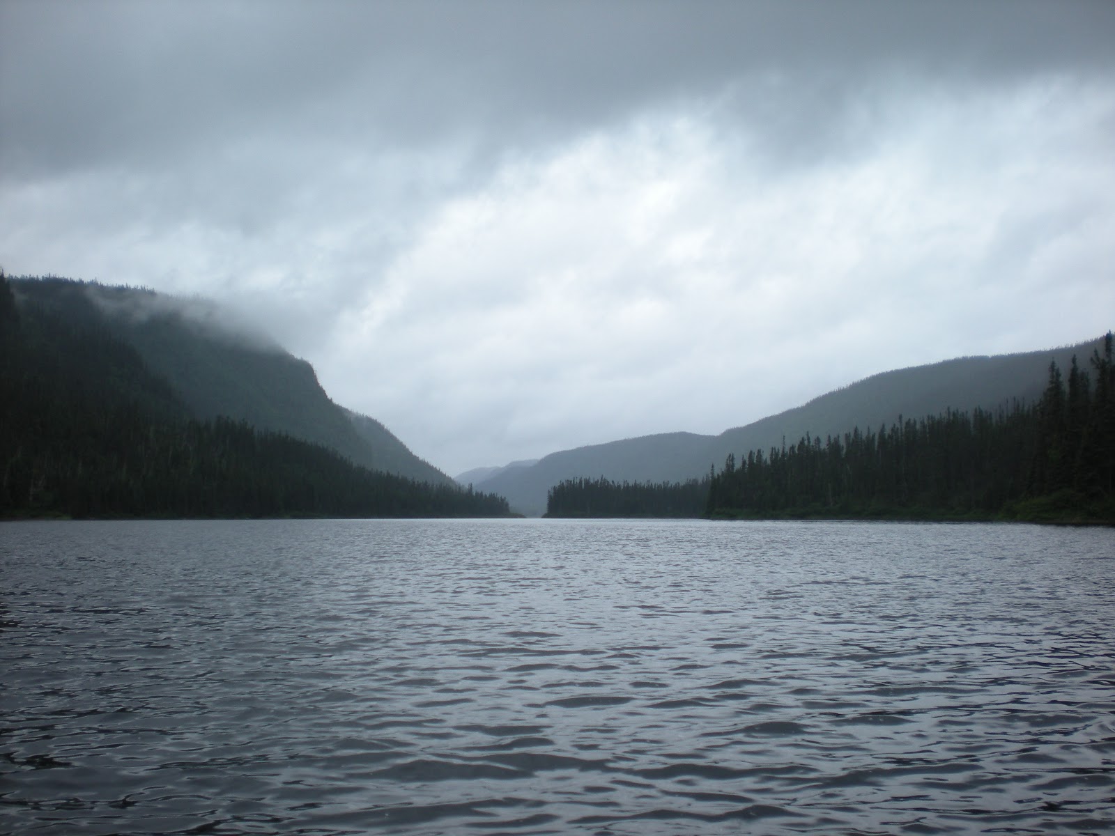
Took out just after k 50 bridge, on left. About 250 miles to La Tuque, a hot shower and dinner at Le Parasol.
Saturday, May 25, 2013
MISTASSIBI NORD EST, QUEBEC, DAY 6 of trip (June 24 to July 1, 2012)
Took out just after k 50 bridge, on left. About 250 miles to La Tuque, a hot shower and dinner at Le Parasol.
MISTASSIBI NORD EST, QUEBEC, DAY 5 of trip (June 24 to July 1, 2012)
MISTASSIBI NORD EST, QUEBEC, DAY 4 of trip (June 24 to July 1, 2012)
MISTASSIBI NORD EST, QUEBEC, DAY 3 of trip (June 24 to July 1, 2012)
MISTASSIBI NORD EST, QUEBEC, DAY 2 of trip (June 24 to July 1, 2012)
MISTASSIBI NORD EST, QUEBEC, DAY 1, June 24 to July 1, 2012
Sunrise was early, four or five; the birds made a racket. Out of the tent before six; lots to do. Coffee and pork chops that had to be eaten. (They were to be dinner but instead had wonderful spotted trout.) Walked and ate to keep the bugs away. All the gear had to be down to the lake and the truck delivered to our friend who was going to take it to the take out for us. Waiting for the float plane at the washed-out dock, we decide to move all the gear to the beach where there weren’t nails and broken wood. Kept watching and watching for the plane. The sky was perfect blue with a few painterly clouds. No wind, the lake very still. Then we heard the rumblings of some shore bird and the big red single Otter plane arrived with its white goose logo on the back—Air Saguenay.
The plane, a de Haviland single Otter had a new Polish Pezetel 1,000 horsepower engine. The pilot came right up to the beach, donned hip boots and jumped in the water to maneuver the plane even closer to us and the gear. He strapped our canoe to the right pontoon with nylon straps and heavy clamps. All our gear was stowed in the back of the plane. Doug gave Trish the co-pilots seat, which she gratefully accepted, Nikon in hand. We followed the path of the river up to Lac Machisque. 45 minutes, 72 air miles.
What a treat to see the river from the air before navigating it. The landing was perfect and we taxied to the plage marked GC (group camp) on the map, the headwaters of the Mistassibi Nord Est. Kilometer 176 on the map.
MISTASSIBI NORD EST, QUEBEC, June 24 to July 1, 2012
Our adventure began well before we arrived at Lac Boisvert for the plane to take us to the put in. Some of it is worth recounting here for those considering a similar trip. Note, there are several other ways to start a paddle on the Mistassibi Nord Est without engaging a float plane.
Our account of this trip, started with the drive on the Abitibi Bowater Road, 12k, 78.7 dusty miles on the logging road. Our Ford 4x4 crew cab was able to do a respectable 42 to 45 miles per hour with the cruise control set. At any rate, that leg of the trip took two hours, following directions and keeping an eye out for various turns. At the designated mile, we crossed over the bridge (double, no guard rails) and found the road to Lac Boisvert, confirming that we had the right one with a middle-age couple on an ATV (many around) who spoke only French. They gave us further imperative: “Stay to the right.”
We took them rather literally and a couple of times had to backtrack as “the right” deteriorated into pure bush. The road up to the lake is very difficult. Huge rocks, steep inclines, only a few hand-written signs. Tough on the toughest truck. Rarely did we reach 10 miles an hour, mostly 5; traveling the 11 miles to the lake.
When we arrived at the pristine lake and the spot where we thought a plane might land, there was no sign of a dock. We went to the north end of the lake and still could not locate a dock. We eventually ventured down a driveway and found a chalet occupied by a family. The father told Doug (who speaks French learned in school and refreshed with regular visits to Quebec) that the dock had washed away; and offered to show us where it was. Sure enough, the sign bearing the symbol for a float plan was buried in the brush.
We found the path down to the lake and decided we would wait there for the plane in the morning–where the dock used to be. This was at the southern end of the lake. Across the road there was a gravelly open area where we camped. The evening’s beauty was marred by the onslaught of black flies. Retreated to the safety of the tent early.
Friday, July 30, 2010
Rivière du Lièvre Day Two
Day 2—Monday, July 19, 2010
Long (and only real) portage in difficult mud around a Class IV ledge, rainy lunch, Lac Adonis, A-rated campsite, swimming in rapids.
Woke early to the sound of the white-throated sparrow. Usual morning prep but skipped the fire and used camp stoves instead. Came upon rapids on the river right away. Scouted a few and lined two. Ran the rest; some good whitewater. Scouted part of a series that was to be Class II, III and a IV ledge. Took the portage trail to try and see the bottom of the series. Trail was long, boggy and muddy. When we got to end with one trip of gear saw a true IV ledge (falls) with very very fast water and not at all runable. Finished the portage, during which it rained heavily. Took shelter under a cedar tree with a moss floor for lunch of soup and cheese and crackers (our usual mid-day sustenance). Some fishermen were tryig their luch at the bottom of the ledge and then a grandpa and kids and poodle with a powerboat. With the river going into and out of lakes, we saw more civilization that usual or than we would later in the trip where it was all river-only access.
Finished the day with two hours on Lac Adonis, a little headwind but an early day into camp and a beautiful A campsite (our rating) on top a ridge with good water access and great swimming in the nearby shallow rapids. Later that night, around 8 p.m., we heard a ruckus on the lake side of the camp, just before the rapids. Two guys had anchored and were yelling in French to other boaters. One guy held up a huge lake trout, three feet long, possibly 25 pounds, showing off his catch before releasing it back into the lake. Before long a few more boats joined the festivities, fishermen talking loudly and casting lines every which way. As sun set, they left around 9. It got quite cold overnight and we slept in caps. A couple degrees cooler and we would have wanted to have 35 degree bags instead of our 45 degree ones.
Rivière du Lièvre Day Three
Day 3—Tuesday, July 20, 2010
Series of Class I, II and III rapids, Lac Bacon and Lac de la Table, lined Class IV ledge.
Usual morning fog and haze over the water. Two quiet fishermen where the boisterous ones were night previously. On the river before 9 for a series of I, II and III rapids as well as two lakes with pretty long flat water—Lac Bacon and Lac de la Table. Scouted the IIs and ran a couple. Would have been rougher and more standing waves if there were just 6 inches more of water. Scouted a IV drop on nice big flat rocks. Had lunch at the top, lined part and then ran the bottom, which was a Class III. All told, paddled 20k or about 12.5 miles.
Missed a recommended campsite and found discrepancies in the map we were using. Ended up in a decent one on an old logging road, a little narrow but interesting. Rock area for a bath. Hearty dinner of chili (from all dry ingredients—hamburger, red beans, white beans, tomatoes and Doug’s secret spices).
Rivière du Lièvre Day Four
Toughest day, flat-water Lac Pine, rain, together ran Class IV rapid, Class IV ledge, bushwhacked campsite.
Seems like there is always a tough day and this was it. Lots of flat lake paddling and relentless rain. No rain jacket is 100 percent but fortunately the rain was not cold. Come midday and we are looking for anywhere we could have our hot soup lunch out of the heavy rain and wind. As if answering a prayer, we come across a fishing/hunting camp. If anyone was there we would have asked if we could just shelter for 20 minutes on the screened porch. But no one was about and fortunately the porch was unlocked. Thank you, thank you.
Somewhat fortified, we paddled Lac Pine, which was interesting with many islands. We checked the grasses to make sure we were going with the flow of the water. Ran the rapids at the bridge fine and then started a Class II, III, IV succession of rapids ending with a ledge that came up so fast we had to take it. Scouted and sucessfully ran a Class IV ledge that at first looked impossible but with planning proved a hoot. Checked out the “grand campsite,” (as termed by others at 280 km) and didn’t find it grand at all except that it could accommodate many tents. Poor fireplace. It was still raining so we decided to go a mile and a half to another campsite that was supposed to be at the end of the island on the left. Never found a sign of it. But, en route we did see two bull moose. Wonderful peaceful creatures that let us get close since we were so quiet. Also interrupted a beaver who had pulled a fresh branch to the lodge.
Came to a Class III ledge and started looking for anywhere to camp, briefly considered a sandbar in the rapids but them came across an abandoned site, all overgrown with moss and shrubs but with the vestige of a fire ring. Didn’t really like it but could not get back upstream past the ledge to reexamine where we might have missed the other site. Quickly set up tent on the bushwacked site and cooked on camp stoves, eating on the rocks because there was no place else. Tent was on very lumpy ground but tried to situate bodies to accommodate. A worn-down tree stump makes a pillow if you are tired enough. Rained hard that night but at least we were dry. In the morning we found an inch of water in the drinking cups.
Rivière du Lièvre Day Five
Doug ran Class V ledge with duffle, great whitewater II, III and IV, dramatic IV ledge, sunny private lake and A-rated campsite.
First thing in the morning, had a class V ledge with good portage on the rocks to the right. We were going to carry the whole thing but Doug decided to sneak it with one duffle as his seat and the rest of the gear carried. Ran fine but got briefly stuck on a rock at the bottom. Ran a good ½ mile of II, II and IV (brief) whitewater with only minor snags due to rocks and the water level. Some big waves, too. Fast going. We were determined not to miss the campsite around 268 km. There wouldn’t be another one until the take out. Scouted and ran a couple IV’s Ran series of II, III, all a hoot, culminating in a big IV banger at bottom boat scouting only. Scraped a small rock , but no sticky. Pulled over into an eddy because we had taken on some water. Sure enough, as promised, just around the right bend, was our campsite, the best yet, we rate it A.
An early day off the river, beautiful lagoon, no other boats around, sun to dry the gear on the huge expanse of high rocks. Took a dip in the deep refreshing water. Enjoyed log seats and a work table. Time to relax before salmon croquettes with Teriyaki rice and vegetable medley. Another cool night. Good sleeping weather.
Rivière du Lièvre Day Six
Fantastic five miles to takeout, ledges and 1.5 miles of great Class II and III whitewater, would have been IV with more water.
Thursday, June 17, 2010
KOPKA RIVER SOLO DAY 9 & 10
TOP Photos L & R
The Mt. Goat portage. Don't trust that rope!iT'S 80 VERTICAL FEET
MIDDLE ROW PHOTOs : Me and third falls > a scene hard earned. LOOKING down over the abyss
********
BOTTOM PHOTOS, LEFT :My truck at the takeout. Where's the nearest pizzeria?
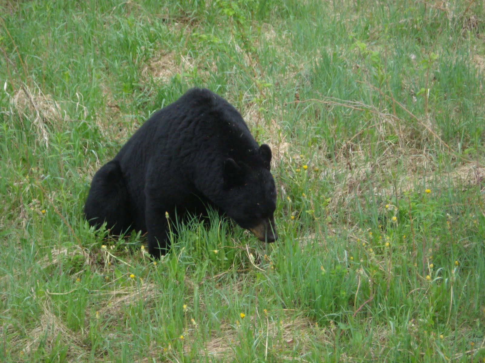
BOTTOM :HELLO BEAR!
*************************************************
The last of the three great waterfalls is just at the end of the lake on which I camped the night before. This biggy has the most difficult portage of the three, the famous "Mountain Goat " portage. It's the norm to do this portage river left, although another route exists on river right. I sort of wished I had at least checked out the other less-used side to see if it was indeed more difficult and longer (as said my old MNR trip notes). It may also have provided a better photo view from the top.
The portage is about 250 yards. Not difficult until the end where it drops a good 80 ft and is very steep, and vertical at the beginning for about 10 ft. I'm glad it wasn't raining. Operating solo the entire job was particularly arduous because I kept the pace really slow to ensure safety. After cutting up a tree that had fallen over the top that winter. (I was the first one on the Kopka in 2010!) I started lowering the gear down, then the canoe. the really steep part is the first 20 ft or so. Then it angles to a pitch that can be walked down by holding on to a rope. I didn't trust the existing rope for my own self, just used it for the gear. Sometime soon the rope tied to that top tree is going to break. It was good in its time . . . real kernmantle . . . but the years are wearing it out. If your going, bring your own rope -- the old stuff might be gone or if not, you probably won't trust it. A few carabiners are going to come in handy, too. The D-Roller tm is a nice one for using as a pulley. I had two with me.
I think the entire portage took almost three hours. In a group the time would be much less because things could be passed up and down. I had only myself there and when all the gear was lowered over the edge, boat too. I followed down on a one-way trip all by myself. The lowering was all done in stages. First a quarter of the way, then the rest. There's enough slope "platform" to keep things from going all the way down in freefall. I anchored a rope to a deadfall to hang on to as I moved down the rest of the way. The top part you climb down straight vertical.
When everything was at the river's edge at the bottom I paddled across to the other side and had lunch at the campsite there. You get a great view of the falls . The campsite though is used somewhat by locals (it's obvious) and a little on the blemished side -- trashy is too strong for it, but time may make it so. Not bad but glad I stayed at my little lake site upstream.
The course out of the canyon is beautiful and a fitting farewell path from the falls. Wigwasan Lake is large and uneventful. It's obvious that heavy winds could wreak havoc on any canoeing on this lake and Lake Bukemiga, but I was fortunate. The narrows into Lake Wigwasan are easily negotiated. About 2 miles past the rapids of the narrows, still in the SW arm of Lake Wigwasan, there is an island with a nice campsite on the south side. I took a break there and noticed a raven had built a nest in one of the nearby pine trees and her little darlin's would make a real racket when she came in with a mouthful of groceries. They probably nest there every year, so you may not have missed out my friend. Also this island would be a good place to stay on overnight if the winds were bad and going to tear you up when you hit the open water of the main lake. It was actually more pleasant than the more humanized campsite at the Lake Wigwasan/Lake Bukemiga connexion trail.
The course can be run easily between lakes Wigwasan and Bukemiga -- by now your an expert, right? Just stay to the right hand channel at the end where the water is deeper and you'll be fine. I checked out the campsite there, where I had originally planned to camp for my last night and decided it wasn't that great, so I just kept on. On Bukemiga, it was raining and I was concerned about the wind picking up the next day so I decided to camp at the takeout and drive off the next morning. In retrospect I should have spent one more night in the real bush instead of the very civilized camping ground/trailer park of the takeout.
There is actually a nice little campsite nestled in the woods on the right bank of Lake Bukemiga in the southeast arm just before it bends right and south for the last 1/3 mi. of paddling. Camping here the last night would just have meant a 20 min paddle in the morning in a protected inlet of the lake, and a fast exit.
Be that as it may, I proceeded to the takeout where I was met by a great furry dog of one of the local fishermen. There were some summer locals camping out in their trailers and they were a friendly bunch who insisted on giving me a few free beers and ultimately a great chili dinner to boot. There was plenty of grass, not rock now, on which to pitch a tent and I knew I wasn't in the wilderness anymore when an electric generator got going. But I had my earplugs, which I use anyway when sleeping near a rapid or waterfall, and I slept like a baby. In the morning I was offered a mug of steaming mocha by my buddy in the trailer and I know I'm back in civilization for real.
The truck gets loaded up and I say my farewells. On the way out I pass a black bear half sitting, lazily eating grass by the road. I roll down the window and say "hello bear !" He doesn't move and looks at me languidly, the expression on his face saying , "You must be new around here , Cheechako. "
I drive off . . . what a trip!
KOPKA SOLO CANOE DAY 8B photos
MORE PICS!!!
Top: Indian Moccassin orchid . . . springtime delight in the north.
Middle: This is the rapid for which I discovered a portage trail after lining became decidedly risky. That current is moving fast and the end drop approaches Cl IV for sure.
Bottom: Checking out #2 falls. I would camp on that little "way down there" lake in the background.