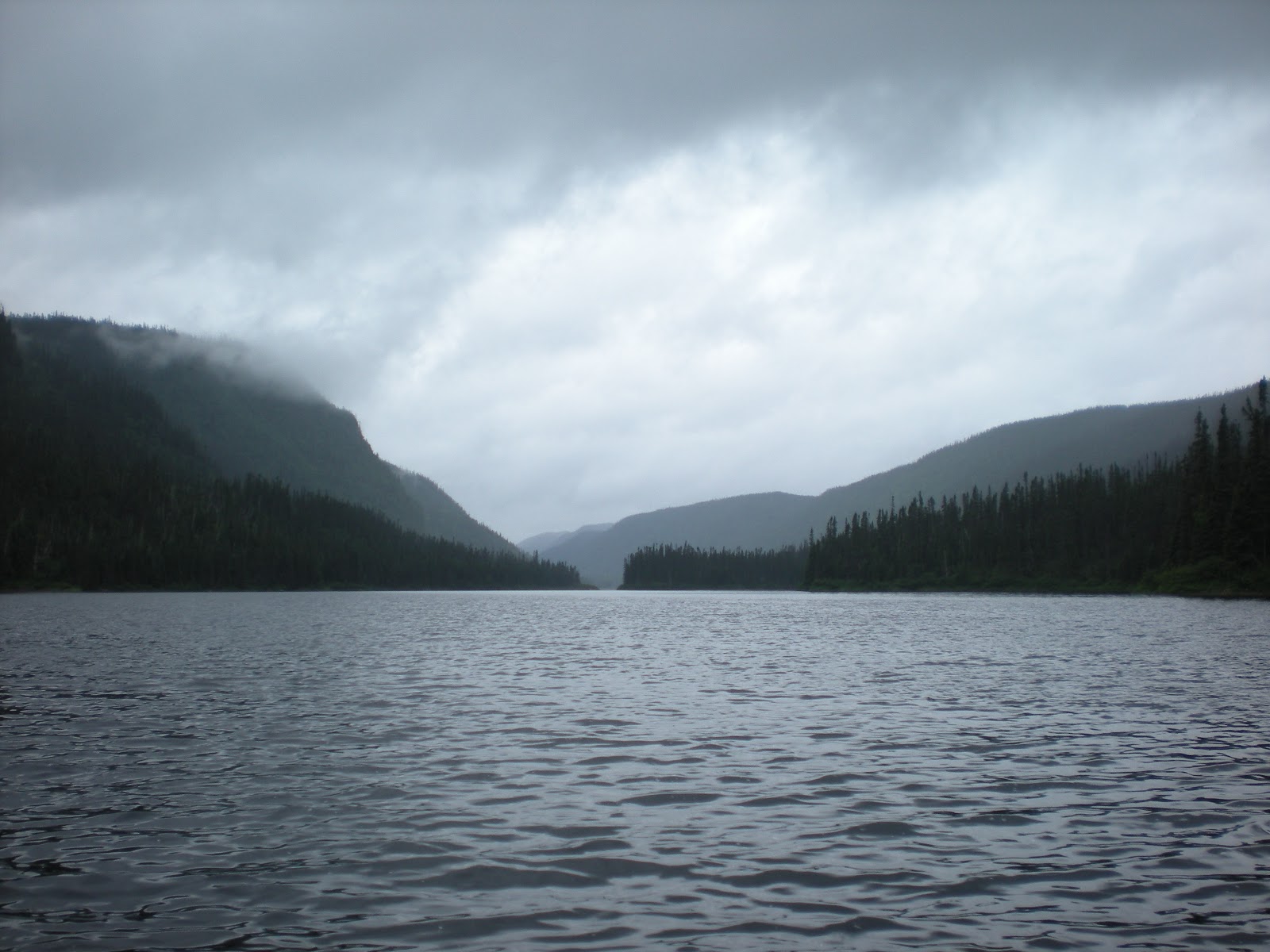
Well this one's going to be different.
The Kattawagami is a great river flowing from north to south over the Canadian shield and into Hanna Bay the most southerly part of James Bay. I planned this trip carefully getting all the topo maps and the "standard" set of map notes with all the major rapids named. My 14th Canadian canoe trip and fourth solo. Looked like a lot of good whitewater. I planned on 11 days on the river.
I used Terry O'Neil as my shuttle man, 1 705 272 5680 , and would highly recommend his services to anyone.
THE TRIP : Started May 26,2011.
After driving about 1000 miles due north to the town of Cochrane (pop 5,500) I checked into the TravelLodge Motel. I called Terry and arranged for him to meet me there at 6:15 am the next day, then drive to the put-in at Lake Lawagamau where my trip would officially start. On the way there I learned the mine at the end of hwy 652 had re-opened due to the high price of gold.
Lake Lawagamau levels were fairly high, a hint of my future fate in itself. Paddling cold headwinds I entered the river proper and paddled under the 652 bridge. The bridge was being repaired by a road crew who barely noticed my passing. The river starts out about 100' wide and for the first few miles there is little current.
At around mile 7 some Cl I rapids were indicated. As I ran them I thought Hmmm these seem in places more like Cl II. Then the first Cl II arrived and getting through that I looked back and said to myself, "That's a Class III!"
And so it went. Every rapid was at least half a grade higher in difficulty than my map notes were indicating , some ,I believe a full grade higher ...even most of the "swifts " were Cl I . The river notes must have been written at low summer water levels. There had been ample snowfall that winter and a late snow melt so things were still way up. I knew I was in for some extra work...little did I know how much.
The first day I did about 17 miles. I found a nice small"unlisted" campsite at about 27 km past the first two listed ones. That suited me well as I wanted to try and make it to Bayly Lake the next day. That night it went below freezing and the water bottle froze solid...but I had a zero degree F sleeping bag and stayed cozy.
The second day was the best for weather, clear skies and sunny. Of the 7 days of river travel, 5 contained some rain. I made it to Bayly Lake and set up camp on the far northern shore. The map indicates "CAMP" there on the shore but I can tell you on that day there was so little shore it was almost impossible to find space to pitch the tent. I ended up selecting the only spot on the whole north shore that had space for a single tent and even then one corner was unavoidably in the wet wave splashed sand right by the water. Water levels were indeed high. I wondered what the first ClII (Pineapple ) rapids would be like.
I was paddling a Swift Raven with a Northwater spraydeck, all new, nice and pretty.
After breakfast on day three I headed to Lake Bayly's outlet and headed downstream. As yesterday the first "swifts" sure seemed like Cl I. Then I reached Pineapple. Sure enough I was staring at a solid Cl IV drop. Pineapple has a left channel that can usually be lined. Well that day there was enough water in it that I simply got in the boat and ran the left channel as a sneak route. It would have been harder in a tandem boat but the Swift Raven proved agile enough. But what about all the other big rapids? This was going to be tough.
Eddie HOP was the next Cl III and as it turned out my campsite for the night. There was a line on the left that looked runnable and I gave it a mental III+ rating. This was going to be one of the "easier" "IIIs" on the trip. The next morning I ran the line and paddled on. Sure enough almost every rapid was a grade higher in rating. It was real slogging. Several rapids that had lining recommendations actually had runable sneak routes because of the high water. The Shute (Cl V) was one-up, ran it on the sneak right. But where lining was necessary it was a real problem. Rocks that were normally dry and walkable in low water were now covered in flowing water and the going was treacherous. Alder bushes came right down to the water line forcing a move into the water many times as well. When I got to Adrienne falls it was time to set up camp and I found the best campsite so far at the far end of the lining channel on the extreme left. Once again lining was exceptionally difficult due to the high water levels and fast current.
OK so far. Staircase rapids proved runnable on the right but it's a solid II+ up to the scouting point so stay right on the way there. Maze falls--a real buster of a portage-- stopped counting the deadfalls at 12. Sure it's listed as a 800m portage and is really only about 400-500 , but the slog will make it seem twice as long. From the portage to Ranabout rapids it's all Cl II so don't think you're still in Adrienne falls territory after running it ...and knowing most Cl III's were now IVs I elected to camp river right and ended up bushwacking a 400 m portage to the river below Ranabout on the right. What a workout! and I only had gone about 6 miles since Adrienne.
What can I say about the next few miles but "more of the same." Every Cl II rapid was a III and every III was a IV. The water was really up. Lining was tough and dangerous. Sometimes it was a tough call between running a rapid and lining because the was danger in both.
It was day 6 and I put in a grueling 10 1/2 hrs of slogging to get to a campsite just above Jackpine Falls. To make matters worse, the wind had picked up the last couple of days and I was facing 20-25 mph gusts at times which was really making it difficult to set up "the line ' or even keep the angle on a ferry. Since the route recommendations on the map were not necessarily the best I sometimes had to ferry across from side to side facing strong currents and daunting winds -- not pleasant when you're a few feet from a Cl IV drop. On one difficult line the canoe took a roll and ended up upside down hanging over a 3 foot drop. No disaster there but the paddles got pulled out by the current and there was an anxious moment as I watched them frolic down the channel then expertly eddy out along the bank. I got the canoe down to them and paddled on.
Found a nice rocky campsite just above Jackpine Falls and snuggled in for the night.
The final day of my adventure I lined Jackpine Falls, crossed the 130 km mark and scouted Peace Falls. The only route was the extreme right channel which I debated running vs lining and ultimately chose to line ...lots of work working the ropes ..the current was pushy to say the least and there was just enough rock at the bottom for me to have to worry about pinning the boat.
Island Rapids: recommendation --
if the water is high DON'T take the far right channel, look for some other route, even if it means extra time or portaging. Reason is if you don't make a clean run of the bottom chute you're in deep deep do-do.
OK , on with the story. Island rapids. I chose the extreme right channel, lining down over a six foot drop (there was enough water and I had sufficient control ) then joining the other "right" channel and paddling a short distance to the "box"...the right channel feeds down to a tough to get out of steep rock slot and it was tough making the decision to run it because I figured I had a 50/50 chance of staying upright -- there was a steep drop then about 100' of nasty chaotic haystacks and boilers . . . but the river beyond looked smooth although with a good current and the next rapids were barely apparent about a km down stream. Should be enough to get over into the big shore eddy on RR if I tipped. Still, I stood around thinking "I don't like this " for a minute then got in the canoe . . . to try going back at this point would be next to impossible. I had to chance it.
The boat headed for the chute -- a brisk wind almost took me off line but I managed to keep it in the right direction, entered the drop well on left and paddled straight. The initial drop went well then a huge haystack swelled up under the boat and lifted it up about 4 feet. The bow pointed down about 45 degrees and buried almost to the cockpit . The spray deck did its job and the boat popped up but with a bad roll to the left, my onside .The low brace cut through the foam and failed to stop the canoe's turning . OVER!!!
The flush from the shoot was powerful. I made a fast extraction and waited for the turmoil to calm . . . looked around :uh oh, I'm right in the center of the river, a long way from shore. That shore eddy looks a long way off and there is current here pushing me downstream. I start kicking hard and angle the boat so that it can have an effective ferry angle to help. After a couple minutes of hard kicking I check my position. Holy Cow! I'm still center river and the current is picking up. I scanned the water now for a rock to try to get stuck on or drift into its downstream eddy . . . yeah there's one but I just missed nailing it by no more than two feet. Down river the next rapid whitecaps begin to appear and I know from my notes they're just the forewarning of a Class VI monster, Arrow Chutes. It doesn't seem likely at this point that I'm going to make it to the mainland in time unless I find a rock or eddy to stop my momentum. Time was running out.
The horizon line of Arrow Shutes was downstream and I could hear the roar of the water. I looked around for anything to get stuck on or an eddy . . . nada.
The current really started to get pushy now. OK I'm going to take the swim of my life . . . keep looking for rocks to get stuck on! At this point I was closer to river left . Just at the lip of the falls in the river left is a large rock. It's now a hundred feet away and I'm just to the left of it ..NO way I can make it to shore . . . the current is ripping way too fast. But the boat is on my right and the painter is in my hand with about 10' of rope between the boat and my hand. I touch the stern of the boat and give it a little push . It angles right and just as I reach the drop the boat snags on the right side of the rock and I'm stopped on the left side hanging on to the rope facing upstream. I can't see what's downstream but I know it's bad news ! I'm actually in the drop and the current is formidable. I try to climb the rope . . . no way. The current makes it impossible. I'm locked in hanging on to the painter with the boat stuck on the opposite top corner of the rock. I can't pull myself up on to the rock . . . I'm right there beside it, so close!!! Then the current starts to push me over the drop. It's going 20 mph now and the boat, I see it , is getting dragged right up onto the rock ! I'm pulling it up as the current pushes me over and down!! So nice . . . but NOT for me; I'm going down. I can't hold on any longer. It's pointless. I took a fast big gulp of air, let go and shot down the falls. Class VI here I come.
***************************************
Since I'm writing this you may surmise I survived.
I knew when I let go of the rope the usual rules of swimming a rapid were not in effect. Recommendation from a survivor: for a VI, take as big a breath as you can and then relax . The water in a Cl VI is likely to be so aerated there is no way you're going to float so don't waste your energy and oxygen by try to stay on the surface . . . surface hydraulics can trap you for days and you'll die up there . The vast majority of water however is moving quickly downstream and if your in that, even if it's underwater, you'll be moving to safer places quickly . Then relax , because flailing around with your limbs is no match for where the river wants to take you and you just run more risk of trapping or traumatizing a limb, and of course burn up more oxygen.
The first thing I noticed was it got completely silent . . . from an incredible roar of the falls to complete silence underwater. I seemed to hang weightless and still for a second ( I had punched through a big hydraulic at the bottom of a 10-12 foot drop). Then the incredible forces of the water started to work. There's no up or down just the force of the water moving me in every direction. No way to fight it so don't even try . . . the brain is still working . . . just relax and let the water move you . . . motion is good . . . means your moving . . . and probably downstream!
After a few seconds of washing machine agitation I felt the current really start to push me. I'm holding my breath but ready to suck in more air if I break surface . It happens for 1/4 second -- didn't see anything, but got another 200 cc of air in my lungs.
Underwater the force of acceleration is unbelievable. I'm moving from zero to 60 kmh in about 1 second. My feet are down current. I feel the neoprene chukka boots, 15" tall with cinch straps at the top and over the foot, being pulled right off my feet. The current can accelerate them faster than my body and it does!! Then I hit more turbulence, another agitator cycle, but still moving downstream. I'm hanging in there determined to survive, still enough air and I'm moving.
Suddenly my head breaks the surface and I'm free. I take some deep breaths and work my way to shore -- a big rock at the bottom of the rapid. I've been under water for about 30 seconds. It's great to be alive. I'm wearing Hydroskins under everything so hypothermia is not an issue --great product!
I know it's over for the trip . The boat is lost with everything in it. Up on the rock I see it -- stuck just where I pulled it in my last effort to avoid disaster. High and dry -- and utterly inaccessible. Time to hit the SPOT device -- and wait for the rescue . Around my waist was a waterproof dry fanny pack. In it was my SPOT device and waterproof matches. I lit a fire and got enough wood to last the night if that was going to be necessary. I had only socks on my feet . The boots were taken by the river.
Six hours later I hear the sound of the Ontario Provincial Police helicopter . . . and we head back to Cochrane 108 air miles.The OPP are very nice. Terry is at the airport to take me to the hospital but I don't need it . . . I really appreciate his concern though I have no injuries. All the bruises scratches and scrapes are from the days before the big swim, like any wilderness trip. That night I'm back at the TravelLodge and chowing down on two burgers with the works. Trish flew to Toronto and I picked her up at Pearson airport the next day then we went to my sister's in London. All's well that ends well.
******************
Comments.
I'd do this river again solo . . . but ONLY in low water. And I'd plan on 12 to 14 days so as not to feel rushed. It's truly a great, wild but also potentially dangerous river and deserves respect. In high water it should only be run with an experienced strong group with at least 3 boats. It would still be a tough challenge but very rewarding and exciting. In low water this would still be a challenge but a whole grade lower in difficulty and any experienced paddler would have a wonderful time. It's tantalizingly remote and the destination is exotic. I had planned on ending at Washow Lodge on the Harricana, and then on to Moosonee. No, I'm not suicidal by nature and this river came out as too difficult at the existing levels to function with a proper margin of safety. Once you get on it though you pretty much have to do the best you can with the hand you're dealt.
I plan on two more wilderness canoe trips this year . . . not as exciting as this one though . . . and that's the way it should be.
The only real regret I still have is for some special little camping stuff that I had to abandon with the boat . . . you know, those things you pick up over the years and can't immediately replace. Ah well . . . .

PHOTO: ARROW CHUTES. Canoe on the rock right at edge of drop. I went down the top narrow (RL) chute which is about 4m wide. Then the trip through the maelstrom. The narrowest part of the shute part is only about 3 m wide . . . awsome velocity. And that's me,out of focus - dark spot ,high on top the bare rock RL center photo about halfway along the rapid with an orange fire at my feet - almost discernable . Taken by Constable Eddy Ferro, OPP, through the helicopter window.